Mauri S. Pelto, NCGCP Director Founded in 1983, Nichols College, Dudley, MA mspelto@nichols.edu
Easton Glacier
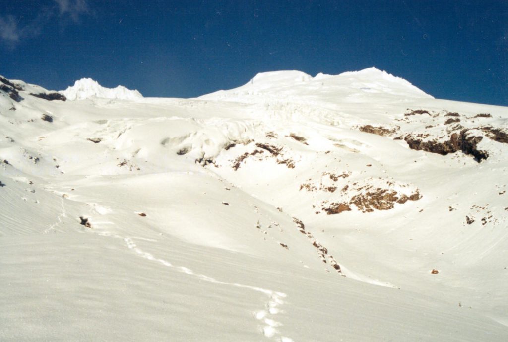
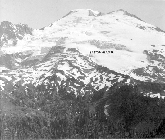
Easton Glacier flows down the south side of Mount Baker. The glacier terminates in a valley confined by lateral moraines that were built during the Little Ice Age, Railroad Grade to the west and Metcalf Moraine to the east. Easton Glacier extends from the slopes near Sherman Crater at 2950 m to the terminus at 1700 m, below the Railroad Grade and Metcalf Moraine. Each summer since 1990 NCGCP has measured the mass balance of this glacier. Snowpack typically increases from the terminus to 2500 m and then remains comparatively constant. In 1907 the glacier ended at 1250 m, by 1947 the glacier had retreated 2100 m (Long, 1953). Changes from 1911 to 2011 indicate the large change in ice thickness and extent at the terminus and limited change in the upper reach. The Easton Glacier has a lower slope than the other largest glaciers on Mount Baker leading to a slower response to climate change (Pelto and Hedlund, 2001). The glacier started advancing after 1954 the last of the large Mount Baker glaciers to advance. The glacier advanced 500 to 600 m by 1979. The glacier was in contact with the moraine emplaced by this advance until 1990. The retreat was the last to begin of the large Mount Baker glaciers, due to the slower response time (Pelto and Hedlund, 2001). By 2014 the glacier had retreated 320-340 m from the advance moraine, 15 m/year. During this same period the glacier has had a mean annual balance of -0.51 ma-1, a cumulative loss of -12.7 m. This is equivalent to a losing a 14 m of thickness. Given a thickness in 1990 between 60 and 75 m, this is about 20 % of the total glacier volume (Harper, 1993). The lowest 350 m of the glacier has limited crevassing and movement indicating retreat will continue. The glacier has developed a separate terminus on the east side at 1800 m. Each summer we complete a profile across the glacier at 1950 m, the glacier has thinned 16 m across this profile since 1984 .
Easton Glacier in 1911 (left) from Park Butte, purple arrow is main terminus, yellow arrow rock knob amidst upper glacier, red arrow is a glacier tongue on the west side of the main glacier, and the blue arrow a glacier tongue east of the main glacier,right is a 2011 image (From William Long, NCGCP Archive)Easton Glacier in 1952 (William Long)Easton Glacier in 2011 from Park Butte, purple arrow is main terminus, yellow arrow rock knob amidst upper glacier has not changed in size much, red arrow is where there was a glacier tongue on the west side of the main glacier, and the blue arrow where there had been a glacier tongue east of the main glacierEaston Glacier in 1990 from base camp.
Easton Glacier in 1998 from base camp. Terminal moraine is the ridge on the right foreground
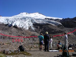
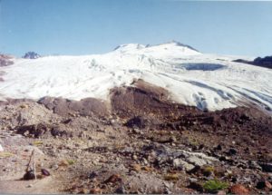
Easton Glacier terminus in 2003 from the basecamp, with 1985 terminus indicated
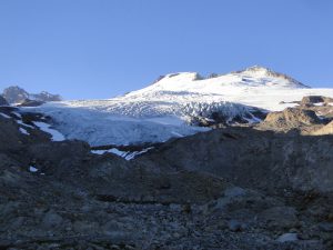
Easton Glacier from base camp in 2014
<
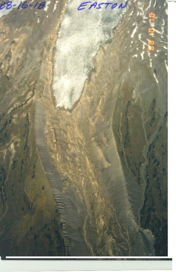
Easton Glacier 1988
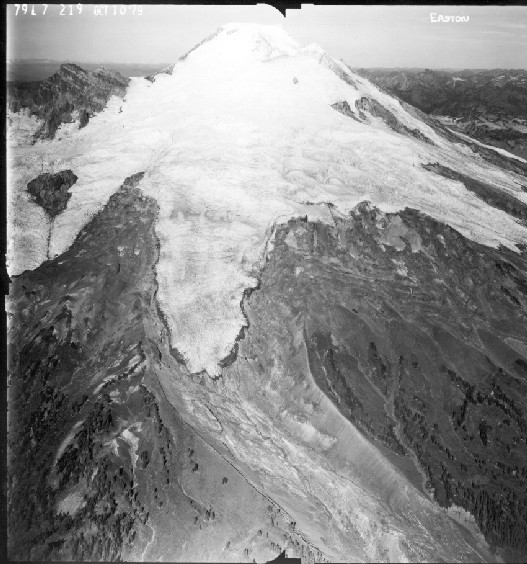
Easton Glacier November 2001
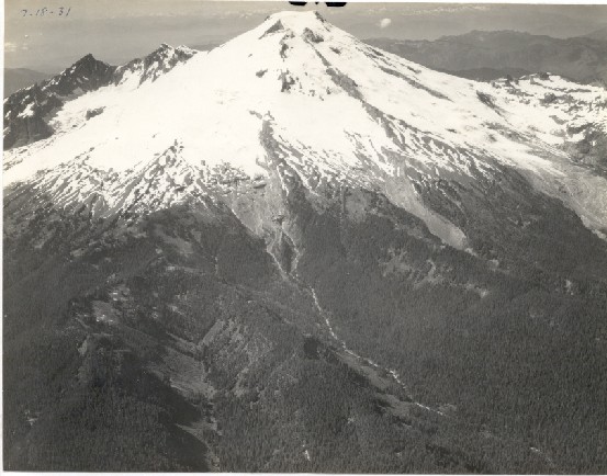
Easton Glacier in 1931 (Wiliam Long)Easton Glacier in 1979 (USGS)
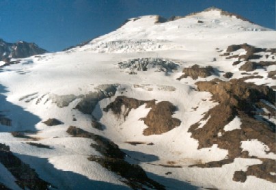
 Easton Glacier in 1990 from base camp.