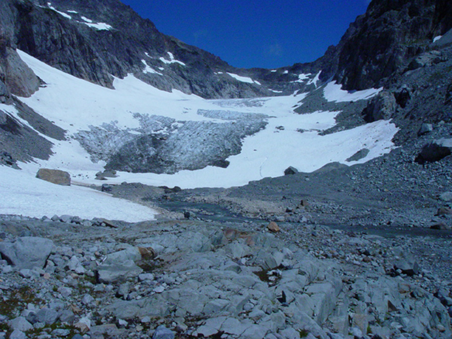
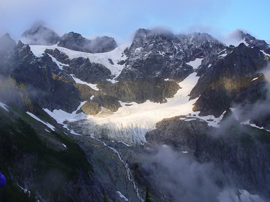
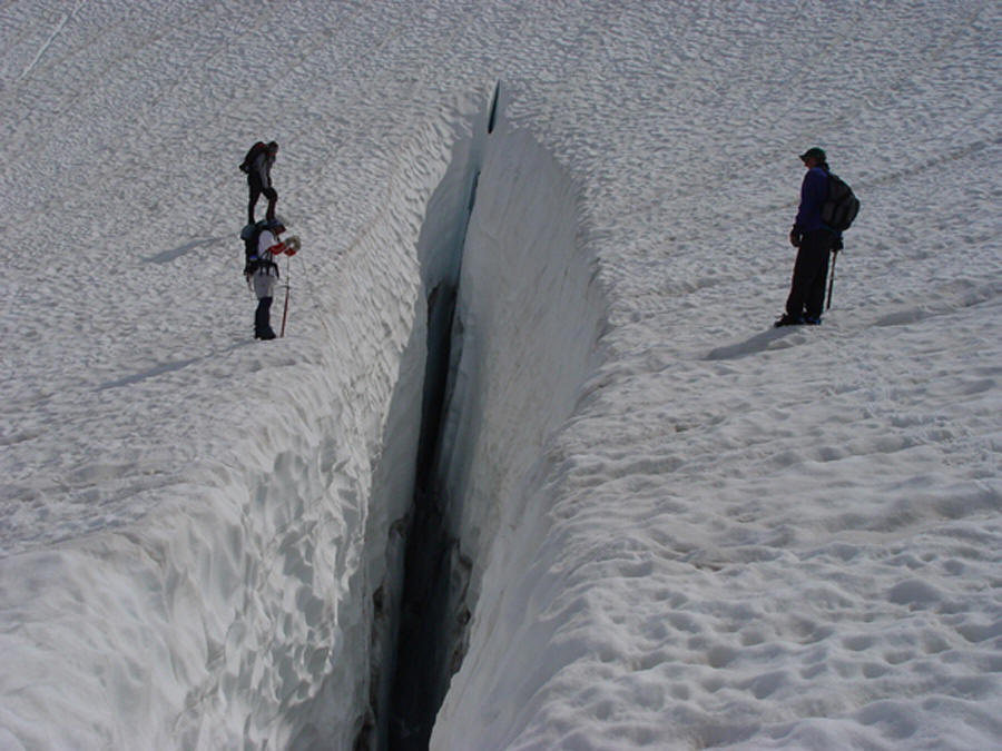
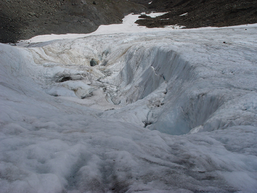
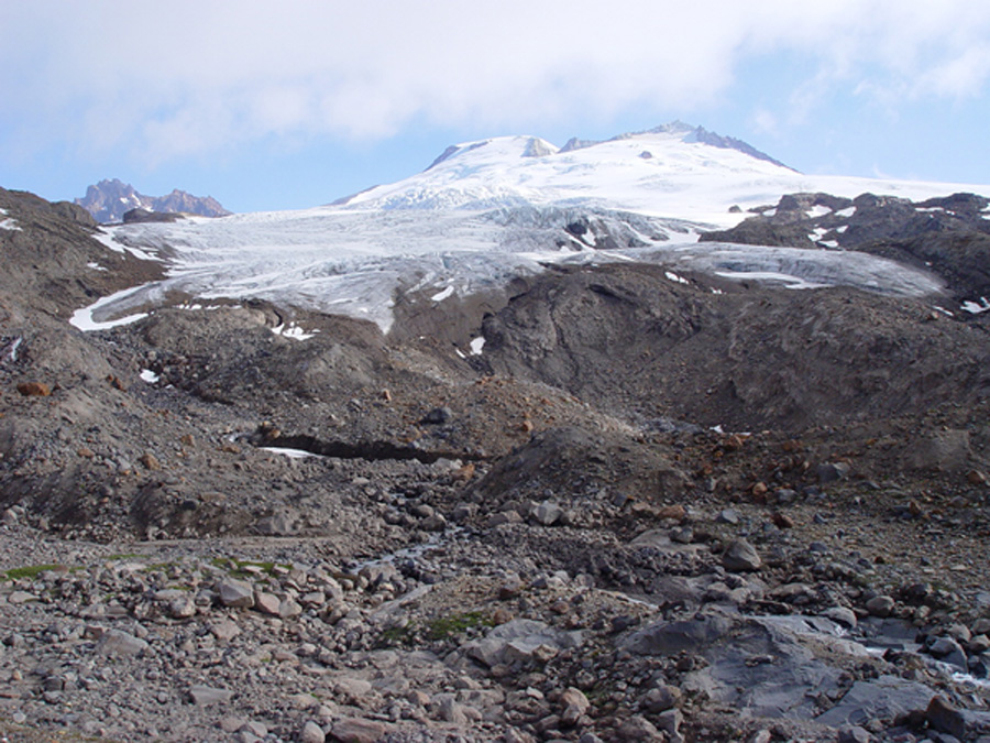
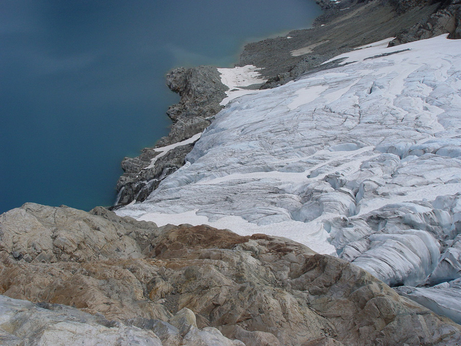
 Our last stop was Mount Daniels. The Cle Elum River was high indicating a the wet spring and decent snowpack that had existed. A swim in the river demonstrated that the current was stronger as well. We waited until 6 pm to hike in, it was still not that cool. The mosquitoes greeted us in number as we reached the first of the lakes along the trail. The rest of the hike to our Cathedral Rock campsite featured few stops do the mosquitoes. We tacked on an extra distance to camp higher, no bugs hopefully, hiking under the rising moon. Morning revealed that the mosquitoes had migrated uphill to this camp which had always been my bug safety camp. Snowpack proved less here than further north and west. The Ice Worm Glacier, the smallest had retreated enough in the last year to expose a new alpine tarn at its terminus. We climbed on some small icebergs in the lake and took probably the first ever swim in this small lake. The Daniels Glacier having retreated 443 meters since 1985, has gotten even steeper and has more melt out crevasses than before. It took considerable effort with probing for crevasses to safely reach the high pass onto Lynch Glacier. We descended Lynch Glacier to the terminus above Pea Soup Lake. This glacier has not retreated in length that much in recent years, but the western third has been separated by a rock rib. Snowpack which should be in excess of 3.5 meters in the upper reaches of the Lynch barely averaged 2 m. After completing the probing and crevasse measurements, we crested the top of the Lynch Glacier up a steep cornice onto the saddle and climbed quickly to the top of the main peak of Daniels, out one and only summit to add to the list of passes and glaciers. On this day we had the mountain to ourselves. We could see from Mount Hood to Mount Baker, the views eastward were as clear as I have ever seen. Foss Glacier on Mount Hinman had another poor year, and is clinging to life, 1/3 of its 1985 area remaining. Mount Daniels after a snowy winter like much of the Cascades, and even a wet spring according to Daryl and Ann Nelson who man the Fish Lake Forest Service Cabin, still managed to lose more than usual to the brutal heat of July. The Mount Daniels Glacier have lost an average of 10 meters of thickness from 2001-2006. Given the 30-40 meters of thickness, this is 25-33% of the glaciers lost in this short period. On the other hand thick glaciers like the Columbia, Lower Curtis, Rainbow, and Easton Glacier only slight less thickness but were twice as thick to begin with.
 The glaciers around Cascade Pass Yawning and Cache Col also featured poor snowpack, leading to a continued thinning of these two north facing glaciers. The start of the Ptarmigan Traverse is used to reach these glaciers, and this trail seems less used of late, maybe do the hordes headed for Eldorado and Inspiration Camps.
The Mount Daniels Glacier have lost an average of 10 meters of thickness from 2001-2006. Given the 30-40 meters of thickness, this is 25-33% of the glaciers lost in this short period. On the other hand thick glaciers like the Columbia, Lower Curtis, Rainbow, and Easton Glacier only slight less thickness but were twice as thick to begin with.
 A quick visit to the glaciers in late September identified unusually high ablation from mid-August- mid- September. A glacier needs about 70% snowcover at the end of the summer to be in equilibrium. Columbia Glacier had 25 % snowcover, Easton Glacier had 40% snowcover, Rainbow Glacier 50% snowcover, Ice Worm Glacier 0% snowcover, Lyman Glacier 25% snowcover. Fortunately the last two weeks of the month were cool, our observation on the week of Sept. 20th indicated new snow cover on most of the glacier areas. At right is Ice Worm glacier (Tom Foster photograph) in early October with minimal remaining snowcover from the summer season.