North Cascade Glacier Climate Project 2010 Field Season- Our 27th Field Season
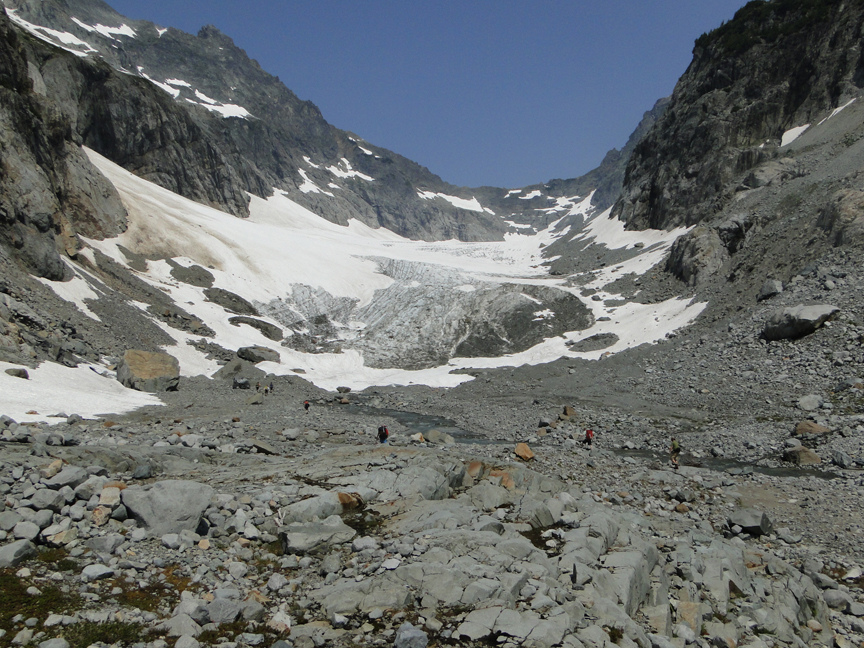
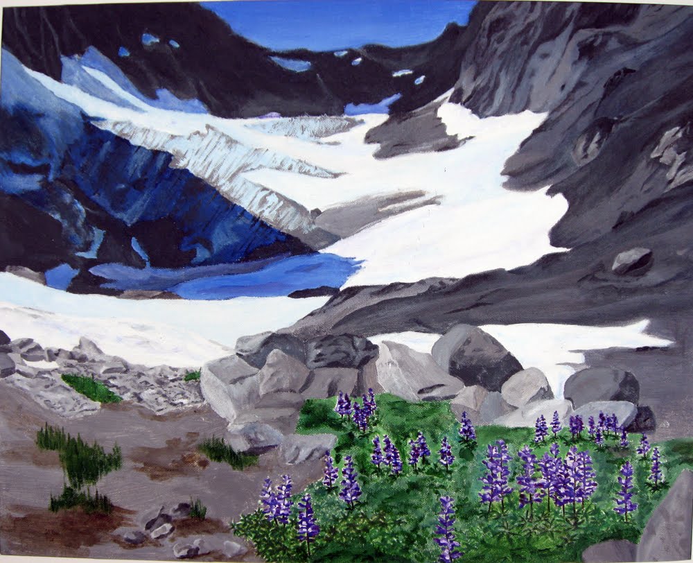
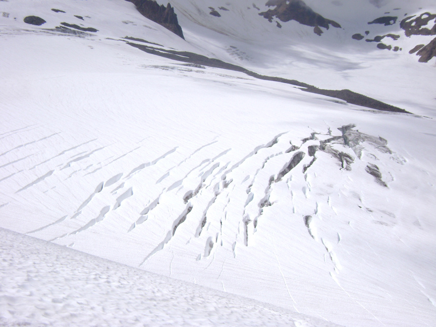
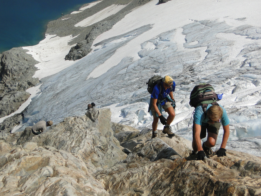
The North Cascade Glacier Climate Project for the 27th year examined glaciers across the North Cascades during the first three weeks in August. This year in addition to our research team (Ben Kane, Mauri Pelto, Ben Pelto, Tom Hammond, Jill Pelto) we had a film crew (Cory Kelly, Christina Crane, Chris Edmonds, and Max McSimov). We began the trip under pleasant conditions with an evening backpack to Blanca Lake. There was no snow at Virgin Lake which indicates below normal snowpack in the 4000-5000 foot range in the area. The first morning began with a ford of Troublesome Creek at the outlet of Blanca Lake, no inadvertent wettings occurred. By late morning we were on the Columbia Glacier (Jill’s sketch on the bottom right) which had snowpack very similar to 2007 and 2009. This is a largely avalanche fed glacier and clearly this winter did not feature many good avalanche inducing storms. The lake at the terminus continues to expand and will melt out considerably during the late summer. We measured the snowpack depth at 214 locations and found the average retained snowpack was 7.1 feet, which is 2 feet below the average and 3.5 feet below what is needed for an equilibrium year.
The second day we ascended to Monte Cristo Pass for lunch, we seemed to have spooked a mountain goat because a short time later we saw one running across the glacier and up the rocks on the opposite side. Our ascent was shortened by an approaching thunderstorm. I have spent three months at this location in the last 27 years and this was the first thunderstorm that actually hit us here. We had three hard showers, more like the Rockies well at Blanca.
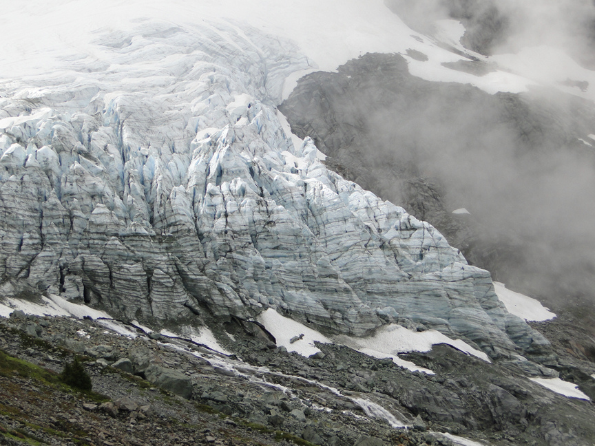
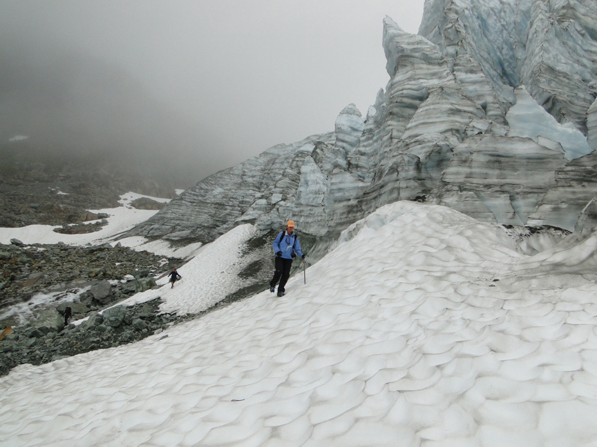
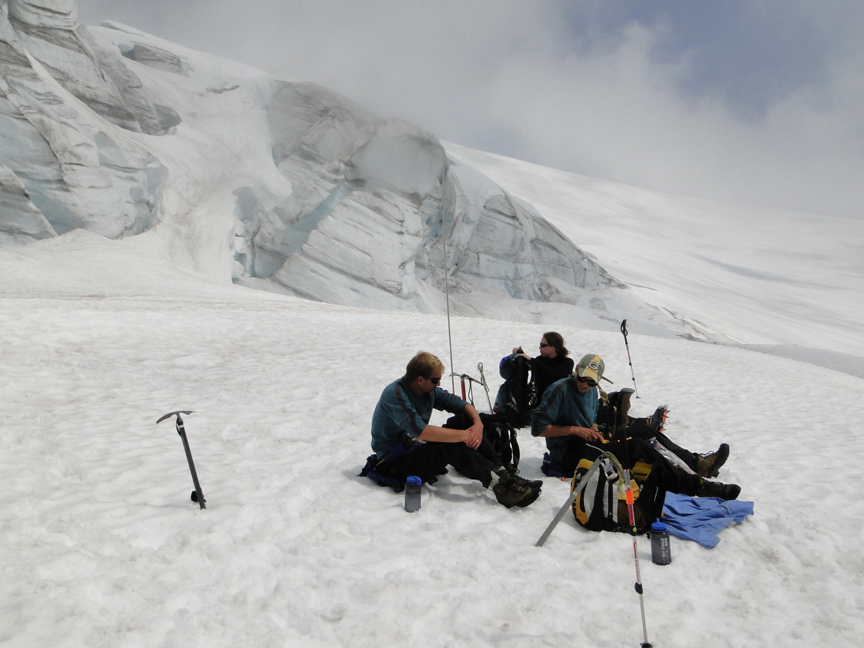
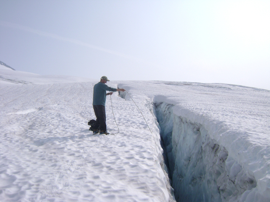
From Blanca Lake we headed north to Baker Lake for a quick swim and then hiked in to the terminus of the Easton Glacier in the evening. At our first glacier site the documentary film crew had asked us to proceed as normal and they would follow. This left the team Cory, Chris, Max and Christina racing after us. At the second site the strategy was modified and we worked more or less as one group. Our first dry day featured a big push up the Easton Glacier. Unlike the Columbia Glacier snowpack was good on Easton Glacier, only a few areas of blue ice were evident. This is not an avalanche fed glacier, and it ends higher than the Columbia Glacier begins. We found an average of 3.2 feet of snow on the lower 5700 foot bench, 7.3 feet on the 6000 foot bench, 10.5 feet on the 6600 foot bench, and 17 feet above the central icefall in the 7200-8000 foot range. Above 8000 feet the crevasses were still mostly closed. Due to the deep snow we were able to probe our way into the heart of the central icefall at 7000 feet and had a fantastic lunch in the sunny whiteout. Steph Abegg had joined us and demonstrated her prowess climbing into the heart of a cleaved serac.
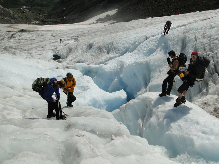
We moved on while she finished her climb, continuing to probe and measure crevasses. Luckily the fog, which had surrounded us higher up, cleared away somewhat and we were able to view the breathtaking Deming Glacier. The Deming Glacier icefall has continued to diminish exposing more of the former glacier base with waterfalls running over them. We spotted a mountain goat, just a speck on the cliff side across from us, hanging out near some greens. By late afternoon the clouds which had been dry but persistent began to part, wet cold feet enjoyed the new warmth. The descent to the terminus was hastened by the ability to jump a number of crevasses instead of circumvent them up.gif , this was a new technique for the film crew. We also enjoyed a few glissades/ butt slides on the way down. In the morning we packed up camp before heading up onto the glacier, as the dry conditions were about to end. We continued probing the lower glacier under increasingly gloomy and drizzly skies, heading down by lunchtime under the beginning of a solid rain. frown.gif The next 24 hours the rain persisted, we retreated to Larabee State Park south of Bellingham to observe the purple starfish, dry some gear at the laundry and keep most of our cold weather gear dry.
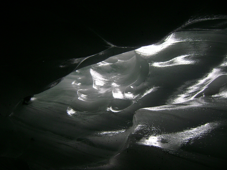
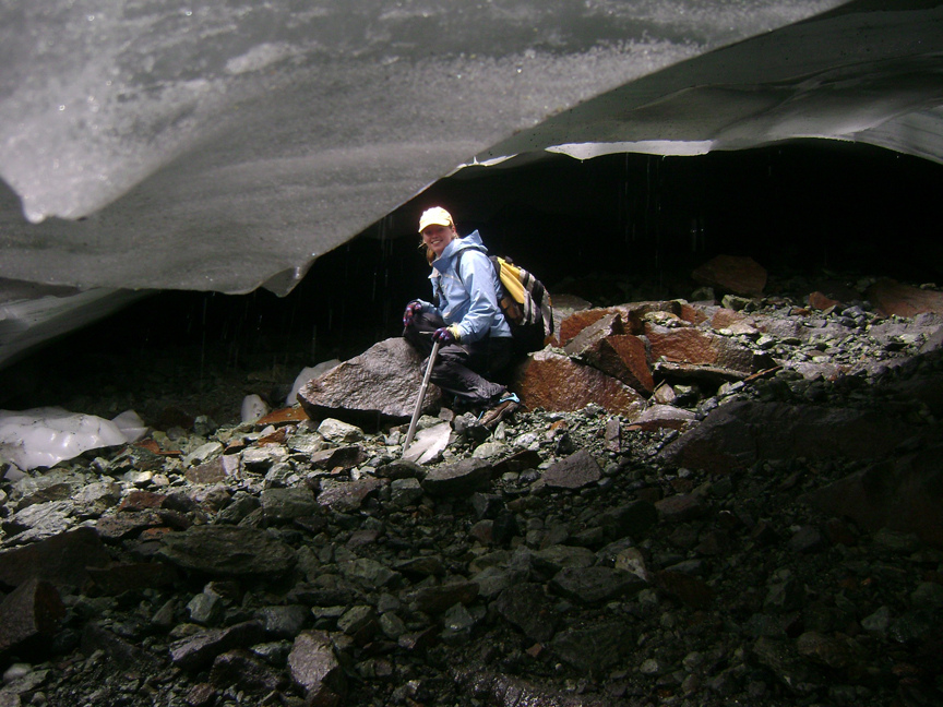
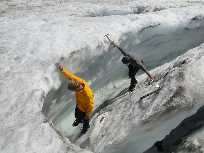
The next afternoon we packed into Lake Ann in cool and misty conditions. The mist let up upon our arrival for a few hours exposing the Lower Curtis Glacier. By nightfall the mist had returned and persisted through the night. Morning gave a brief clearing, yes! a good day. We dashed up through the wet vegetation to the glacier, only to find the blue sky had been measurable in minutes not hours. The traverse beneath the large seracs of the Lower Curtis Glacier terminus was just possible and we were able to go into a small ice cave at the bottom of the seracs. This is a spectacular spot, and one that has to be visited early.
The glacier had retreated 10 meters since last year. The film crew joined by Denny Trimble on the next two legs was well positioned for this traverse. Lower Curtis Glacier looked more like the Columbia with modest snowpack. The snowpack around Lake Ann was also unexceptional. It seemed that below 5000 feet snowpack was quite modest again, and the avalanche fed Lower Curtis just did not get its share of avalanches, the main basin of the glacier average only 7.8 feet of snow left. We saw yet another lone mountain goat on the cliffs to the left of the glacier, around the general are we’d seen one the previous year. Most surprising the work on the Swift Creek trail had continued and was reportedly in good condition after two decades of neglect. dance.gif We returned to camp in a hard rain, we could have dived into the tents for a prolonged period of relaxation in dry clothes out of the rain. However, we chose to pack up and march out and get dry for the hike in on Ptarmigan Ridge. We stayed at a cabin near Mount Baker with the film crew, busy drying all our gear and the next morning said so long to the wet weather that had dominated our first week.
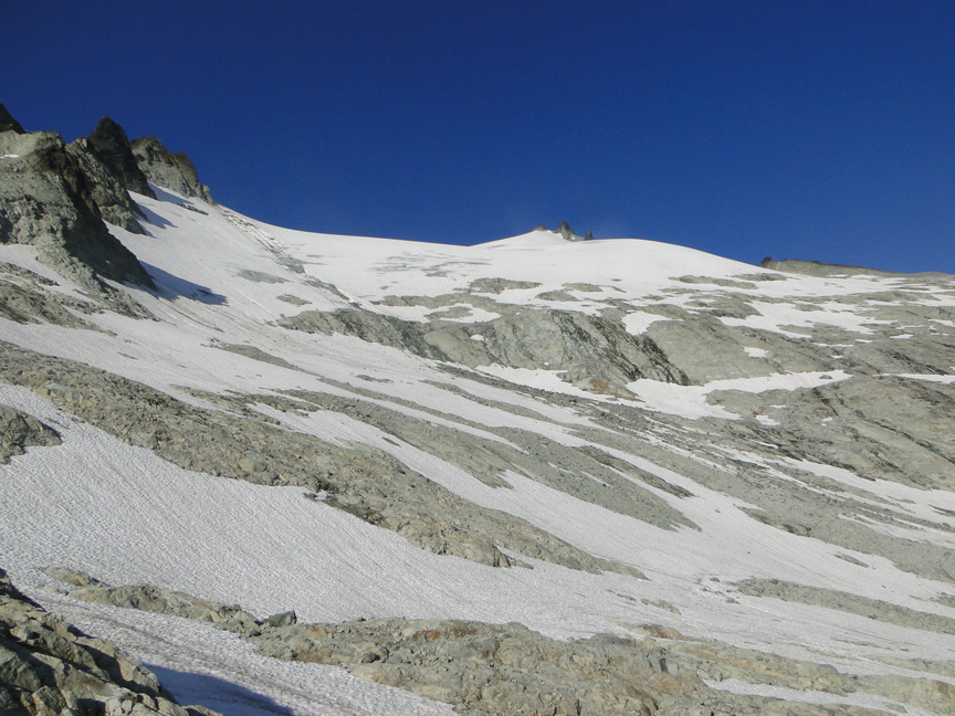
It was ideal for hiking in along Ptarmigan Ridge, cool and dry. There were no footprints beyond the Chain Lakes trail after three days of rain. We saw a herd of 18 goats en route to camp. The trail out Ptarmigan Ridge had more snow than usual unlike the Lake Ann trail. Our usual campsite provided a perfect setting for three days and four nights. The first day we worked on the Lower two-thirds of Rainbow Glacier, measuring snowpack, glacier width and glacier surface stream velocities. Snowpack was good but not great below 5600 feet. The Rainbow Glacier provided one location where a glacier stream dropped into a moulin, to reappear further down-glacier.
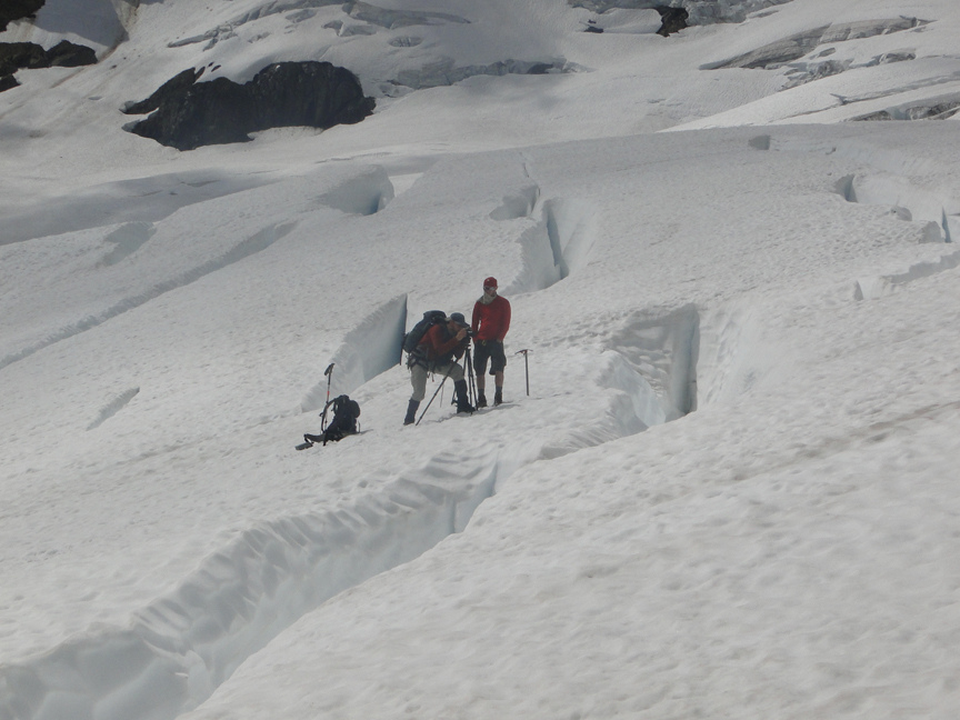
Our velocities test indicated the flow rate was one-third the speed of adjacent surface streams over the same span. From the end of the Rainbow at 4400 feet it is a long slog back to the portals at 6200 feet then across the Sholes Glacier to camp. The film crew was in motion at camp getting time lapse photography of clouds, Mount Baker the setting sun. The following day we set off early to cross the Sholes, pass through the Portals descend to the Rainbow Glacier and traverse up it measuring the very good snowpack from 5600-6600 feet, average depths were 21 feet of snow remaining in this section, four feet above normal. We spied a mountain goat trying to navigate an area where a snow finger reaches up to the rock, the area we planned on crossing on our hike out. We navigated past and measured many large crevasses on our way to the head of the Rainbow Glacier. Beyond the top of the glacier we descended onto the Mazama Glacier for lunch, hopping over small crevasses like an obstacle course.
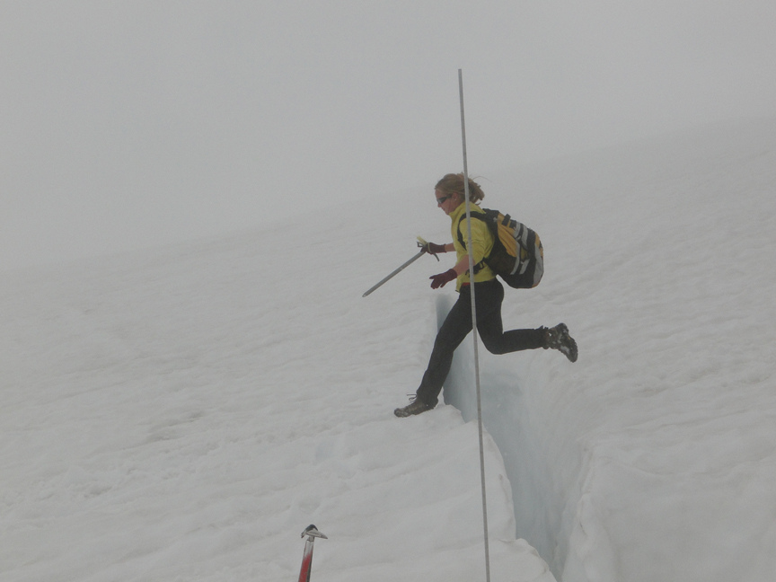
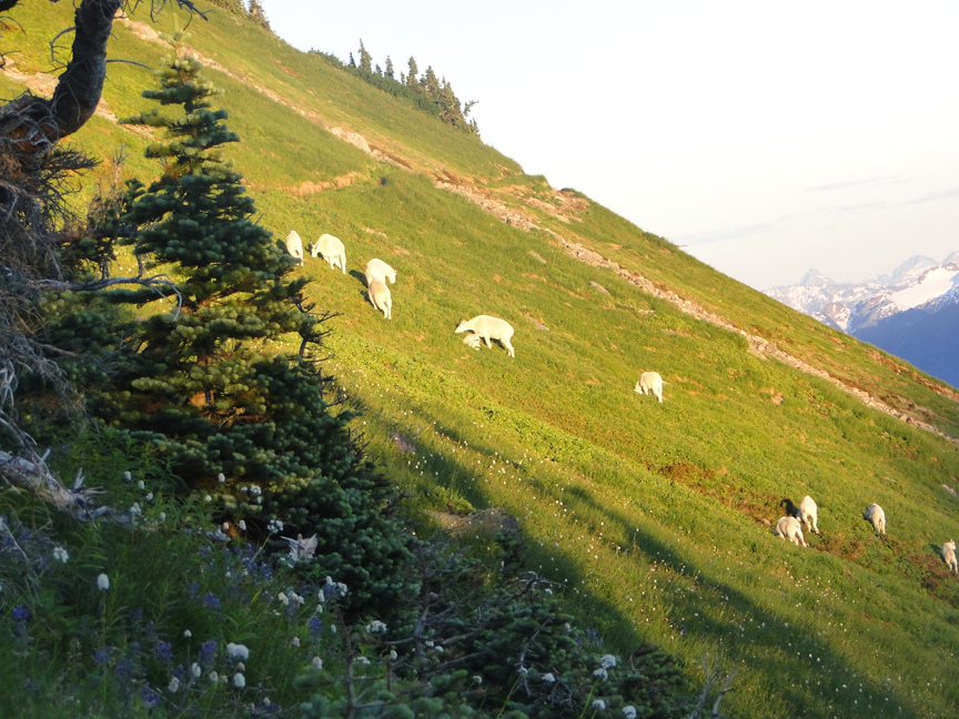
The main entertainment at lunch was the 75 to 80 mountain goats on Dobbs Cleaver. This was the typical herd that is on the Sholes but had moved one ridge over. After lunch we descended the Mazama Glacier into a seldom travelled region, to the snowline at the top of a large icefall. A new outcrop of rock with a waterfall had emerged in the midst of the glacier just below a section of this icefall. This was our goal to see how far up significant thinning extended on Mazama Glacier. The answer: 6300 feet. Above this there is no sign of significant glacier thinning. At this point we were more than four miles from camp and threatening clouds suggested, it was not prudent to continue to descend and move further from camp. As it was we did not get back to camp until 6 PM, exhausted and hungry. The return featured a different route on the northern edge of the Rainbow Glacier past its upper Icefall. The route was less treacherous than usual with the high snowpack. A traverse towards the portals was going well until the snow finger we’d spied the mountain goat on abruptly ended at a short gully that was not pretty at all. After 15 minutes of contemplation and a few short slides by Max and Cory ending in self-arresting to keep equipment dry, as it just a gentling snow slope below us., we found a way around this by with Ben P. leading the way stepping onto a stable bench, each person then was braced by the person in front of them on this stride after passing crampons and packs across the gap. We then ferried our packs and gear over this short cliff to the easy snow above and proceeded to camp. We had concentrated on this so much, that we had not noticed the sky clearing. Except Denny and Chris who were busy filming the episode from below. The third day, we split up. We were having an easier day just measuring the Sholes Glacier. The film crew packed out that morning, Jill headed out to draw some of the small, aqua lakes a 30 minute hike from our camp, and the rest of us headed up to Sholes. Jill relocated a spot she had drawn from the previous year, and set to work finishing her sketch. The lake had enough snow on it so that Jill could easily jump down onto it and explore the snow pools and indented spiral cones created by the water.
Throughout her morning and afternoon the herd of mountain goats we had seen hiking in lounged on a grassy slope across the lake. When Jill hiked back to camp, in late afternoon, the herd moved down the dusty clearings below the lake and ridge. There were 38 in the evening light near camp. smile.gif The next morning we enjoyed another beautiful hike out and the goats were lounging along our way.
It was a hot day and once we’d made it out to Daniels we went for a swim in a popular rafting spot in the Cle Elum River. We did not bring any light beer, so looked out of place. We felt cleaner and cooler as we met up with the film crew at the trailhead and started the long hike up. We reached camp around 9, just as the mosquitoes were going to bed. We lay and watched the stars for a while, viewing many shooting stars which were part of the Perseid meteor shower. In the morning we realized that we were caught in mosquito-heaven as they constantly swarmed the instant we stepped foot outside the tent. We hike up to Ice Worm Glacier for an easier day. We did some stream measurements while Jill headed off to draw. After, we met up with her again and headed up the Ice Worm glacier, probing and mapping it. The average snow depth on the glacier was 6.9 feet. We had fun glissading down a bit as we finished probing and headed down to the bottom of the glacier for lunch. The rest of the day on the glacier we intermittently relaxed and measured the streamflow. We hiked down to greet the swarm and relaxed mostly in the tent until the mosquitoes went to bed, again watching the stars. Our last glacier day (and arguably the hardest), we ascended to the ridge above our camp at 7:30 and followed a mountain goat trail through the talus until we reached the Daniels Glacier. The Daniels Glacier had two new rock islands that had been beneath the glacier until last summer, now exposed. The lower stagnant terminus zone that had separated from the main glacier in 2003 had melted completely away in 2009. The main terminus has now retreated 500 meters since 1984. The long lower terminus extending north toward Pea Soup Gap has also retreated 400-500 m across its entire width. Before ascending we put on our crampons and viewed two packs of mountain goat, two against the horizon on the Daniels, and five below us in the snow and rocks. We ascended slowly up the steep snow, probing and recording our coordinates.
We crossed over a small rock ridge onto the Lynch Glacier. We then traversed right across to the ridge looking down onto Mount Hinman, probing the snow depths and assessing crevasses as we went. A new lake had formed at the base of the former terminus area of Foss Glacier. Foss Glacier had a tough year in 2009 and is not a substantial cohesive glacier area anymore. We descended the Lynch Glacier toward Pea Soup Lake reaching the shore of the lake after a steep crampon descent. The glacier had thinned and narrowed and was less steep, but had retreated little in the last five years. Now we faced the prospect of ascending all the way to the head of the glacier a mere 1400 feet above. Snowpack was limited on all of the Mount Daniels glaciers. We did not hit a zone of more than 10 feet of snow until near the head of the glacier at 7400 feet. The snow slope that emerges just east of Daniels main summit was not as steep as usual. However, the bergshrund had just one snow bridge left, that by now is out of form. It was narrow, we could see its depth and could probe the onramp (solid), it was a slightly downhill crossing, then it was time to scoot across. The summit did not have the usual flying ants, which allowed for the film crew to acquire some long interviews of each of us as we sat astride the summit. The descent of the Daniels is steep 34 degrees. We zig-zagged, getting additional measurements and finding limited areas of more than 10 feet of snowpack. The glissading was great at the top and more challenging below. Max, Chris and Jill demonstrated their self-arrest form. The Daniels Glacier will continue to lose area, rapidly retreating toward the upper slopes of the east peak and middle peak of Daniels. We reached camp at 7:30, darn only 90 minutes to savor the mosquitoes. Christina fixed some delicious cheese cake to cap off the dinner. A trip to the Ice Worm in the morning provided an opportunity to assess the melting from our stream flow measurements. The stream was high indicating the loss of 5 inches of snowpack per day. The hike out was tough on the knees, as the legs after 16 days of hiking were no longer quite as nimble.
A week of wet, unstable weather, and a week of constant sunshine was appropriate. This was an up is down year for the glaciers. Low elevation glaciers, glaciers fed by avalanching and glaciers south of Glacier Peak did not fare well and will lose mass this year, (Columbia, Daniels, Ice Worm, Lower Curtis and Lynch). Glaciers that have good accumulation areas above 6000 feet and are in the northern part of the range did well (Easton, Rainbow, Sholes). At Cascade Pass, Cache Col fell in the middle with ok snowpack reflecting its mixed situation of relying on avalanching, but being higher in elevation.